The Greatest Show on Earth
I grew up exploring and falling deeply in love with Pacific Northwest landscapes at the intersection of two of the Earth's greatest natural events.
But it is only since moving to north-central Washington that I've come to fully appreciate the power and splendor of these two overlapping events.
What makes these events so spectacular is that they occurred over vast areas—and relatively recently—so their features are well preserved and easily observed.
First Lava...
The first event was a series of lava flows that originated from a giant field of fissures around northeastern Oregon.
However, these were no ordinary lava flows. These lavas were remarkably fluid, so they flowed quickly and easily over vast areas, with some flows extending from eastern Oregon to the Pacific Ocean.
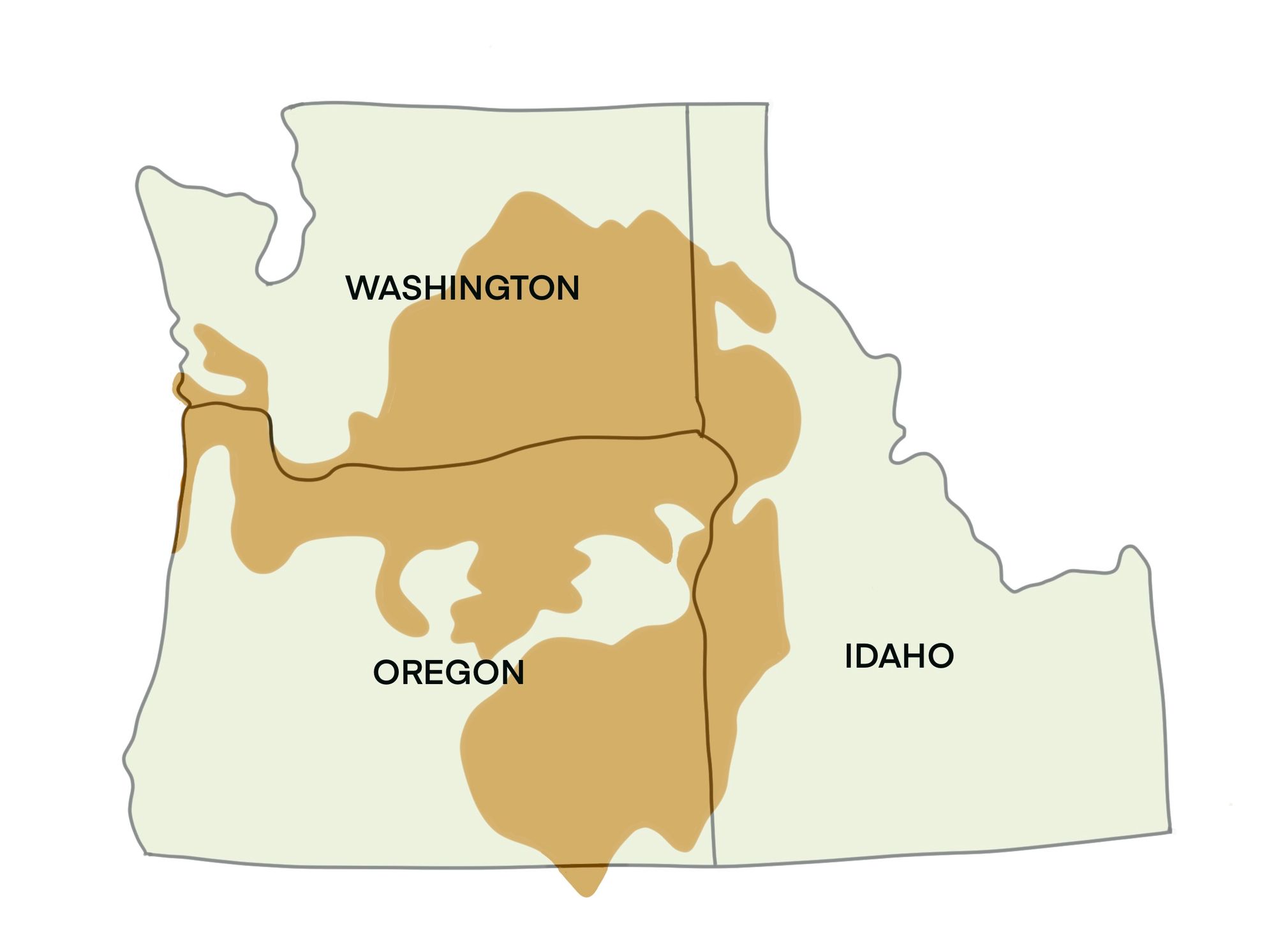
Over 300 different lava flows happened, one after another, for nearly 11 million years (from 17 to 6 million years ago); with each new flow being added on top of older flows, creating a distinctive landscape that looks like layered cake.
These types of lava flows are known as "flood basalts," and while the Columbia River Basalts of the Pacific Northwest are not the largest flood basalts in the world they are the youngest, best preserved, and easiest to see from popular roads and viewpoints.
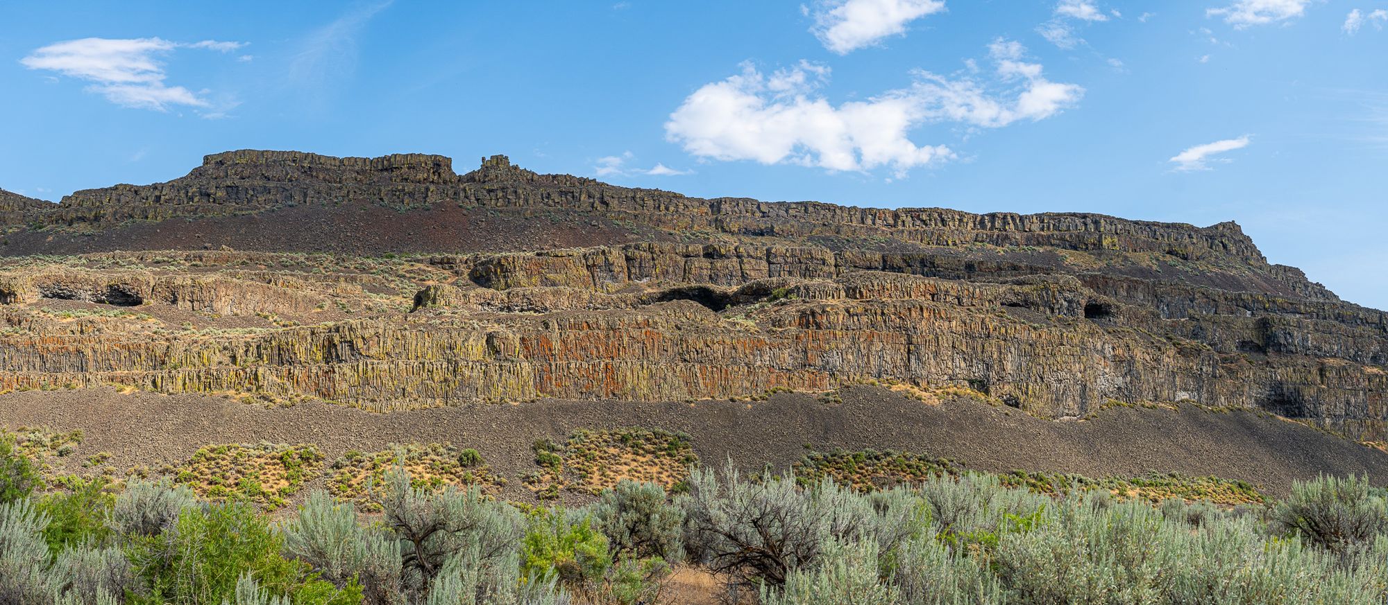
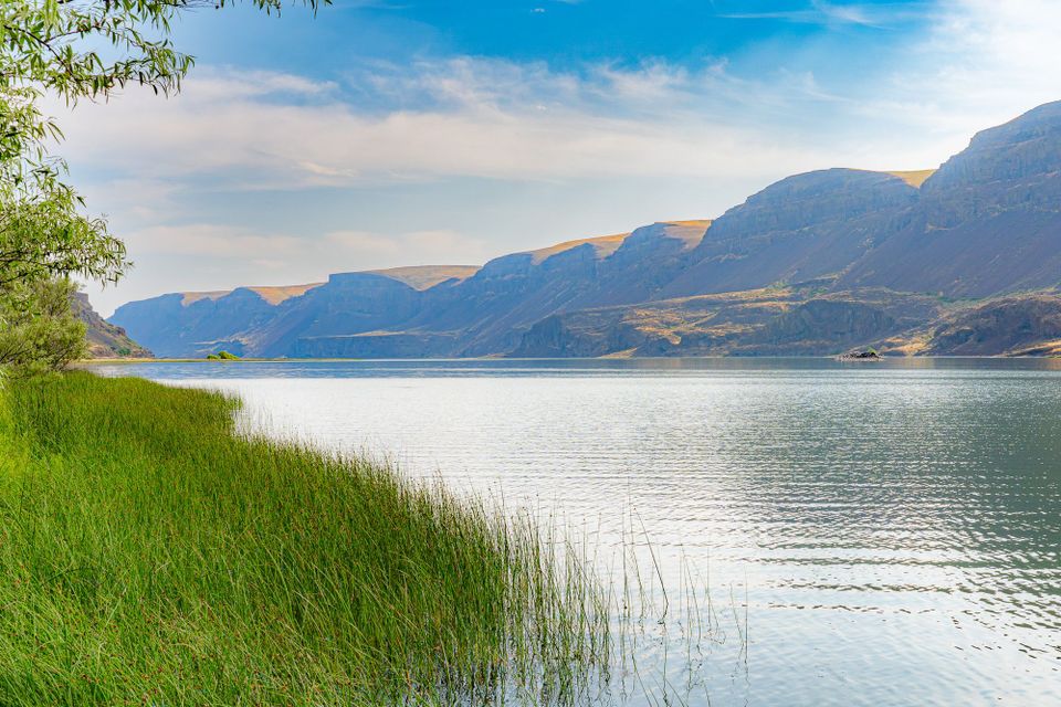
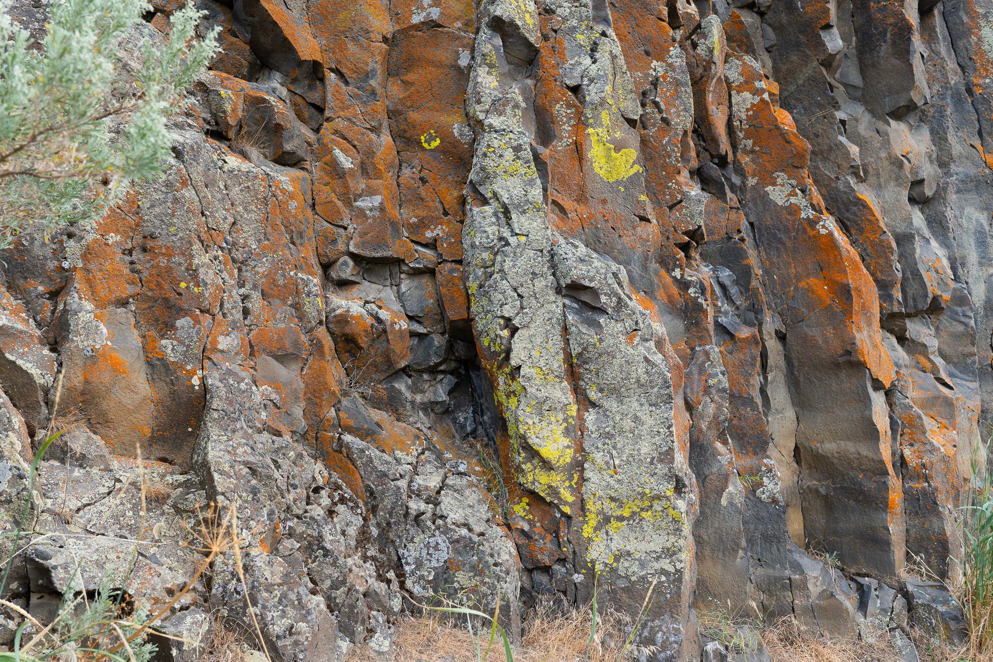
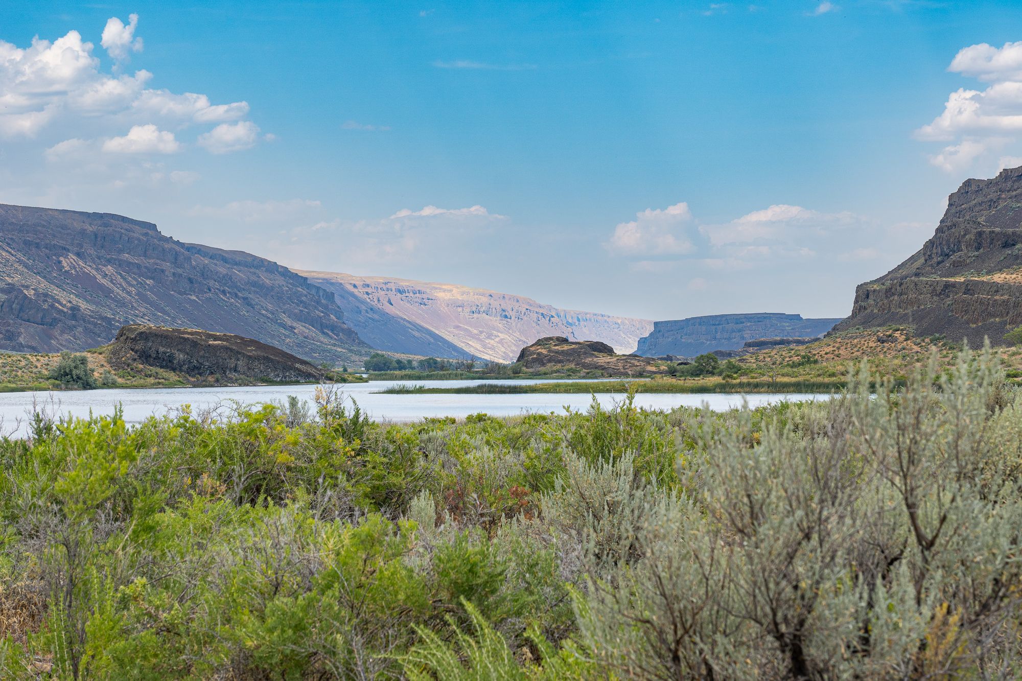
I am deeply in love with these Columbia River Basalt formations because they form beautiful cliffs of six-shaped columns with sprawling talus fields and hidden alcoves. I have spent years of my life walking along the bases of these complex cliffs, looking for great horned owls sleeping in cracks, and admiring colorful lichens that come alive after rains.
...Then Water
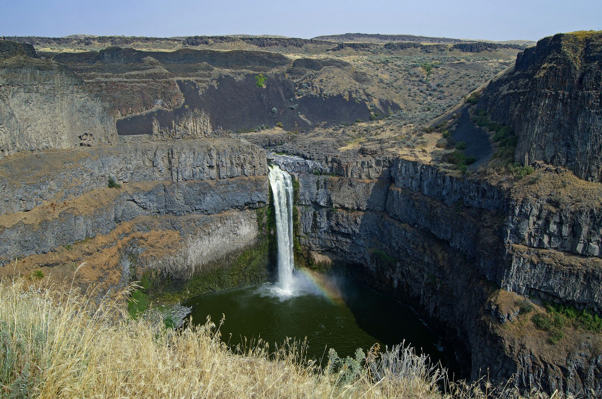
As if these lava flows and basalt cliffs weren't dramatic enough, the final touches came 18,000 to 15,000 years ago when the most massive floods the Earth has ever witnessed swept across this region.
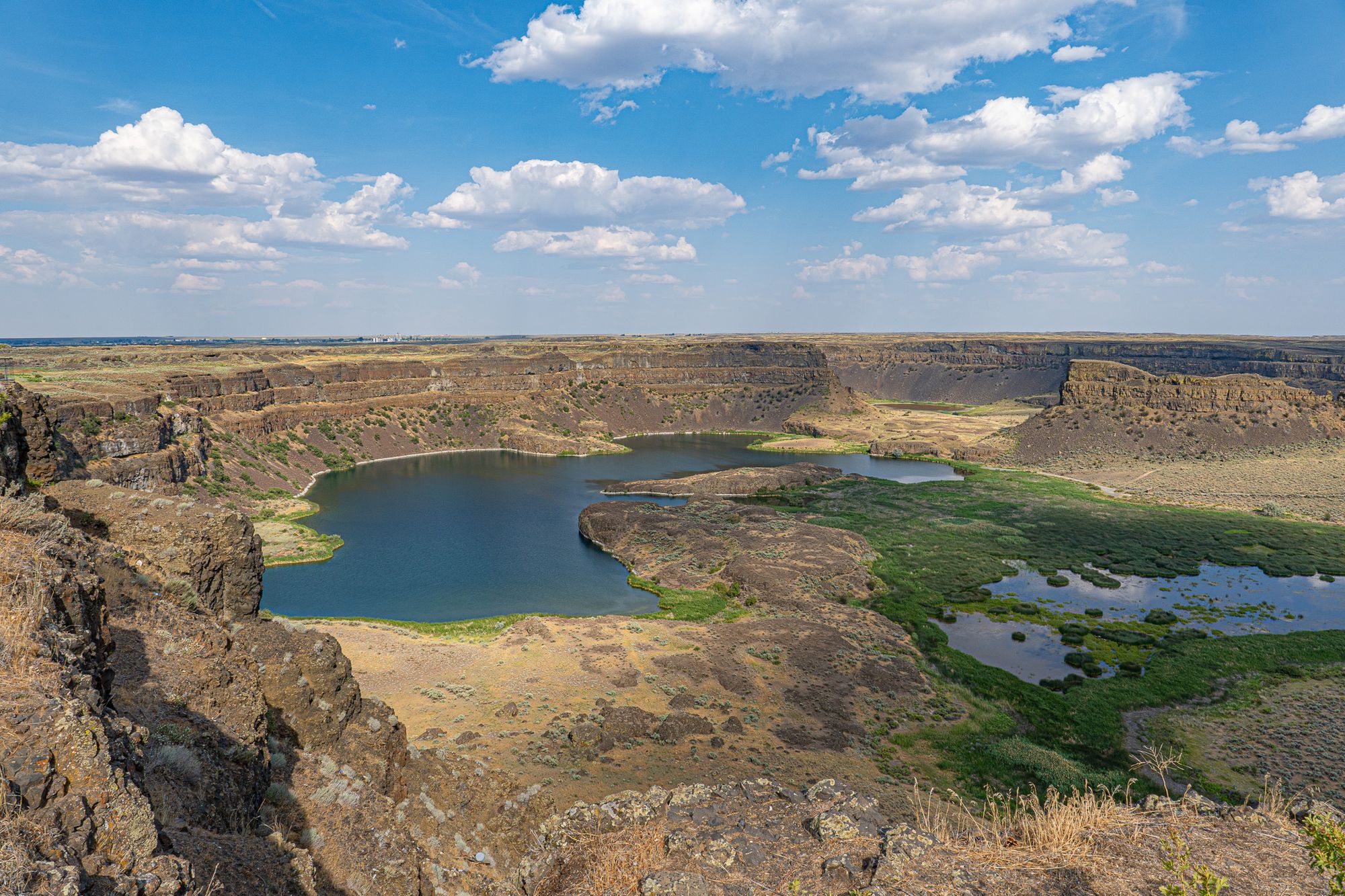
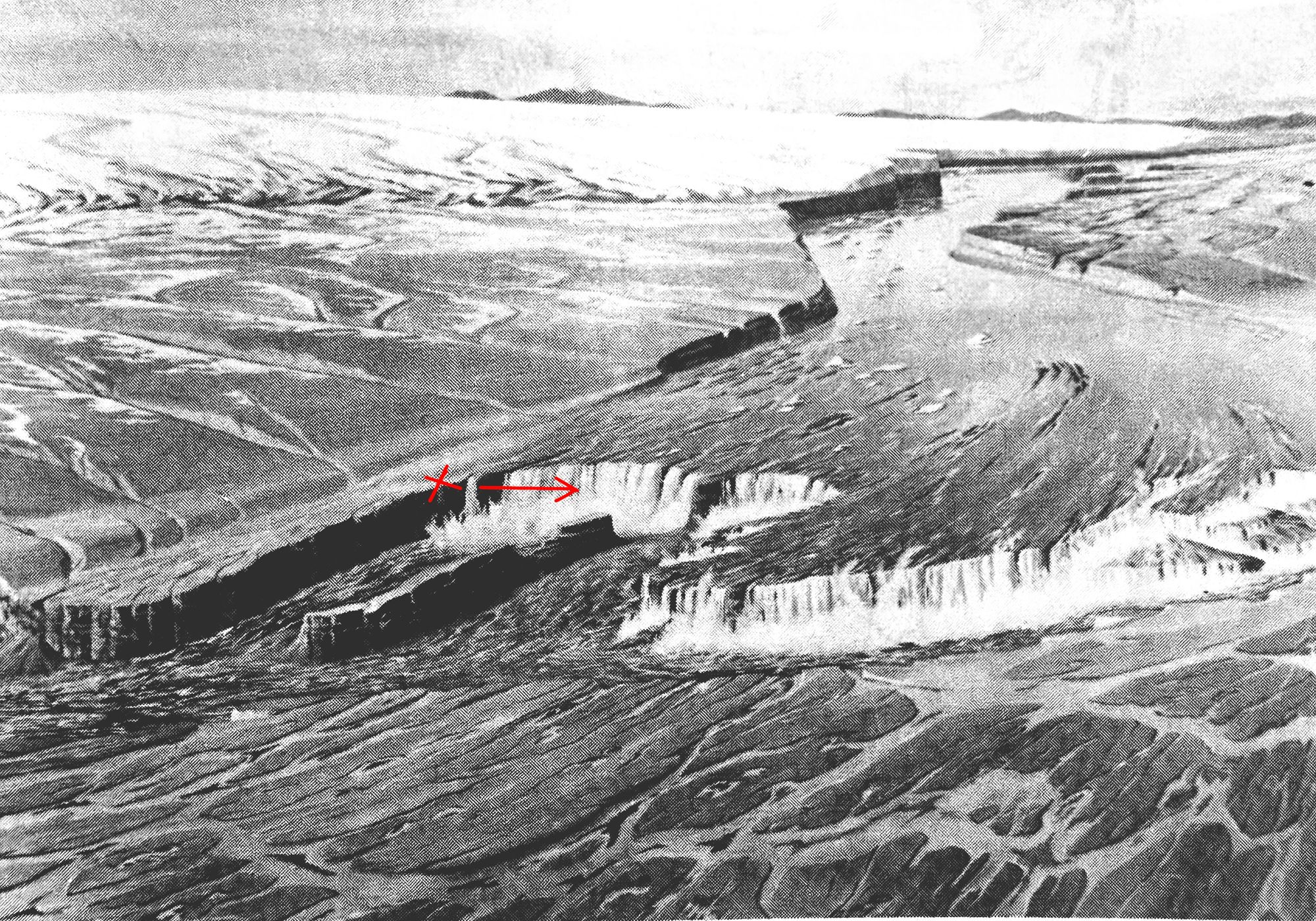
Dry Falls in central Washington was the grandest waterfall in Earth history—five times the width of Niagara Falls with ten times the flow of all the current rivers in the world combined. The falls are now gone, but the sculpted cliffs are still on full display. The location and angle of photo on left is marked with a red X and arrow in the right illustration. Photo by David Lukas, illustration by Dee Molenaar courtesy of Washington Dept of Geology and Earth Resources
These floods originated when a lobe of glacial ice extending from southern Canada into the northern United States blocked a major river in western Montana, creating an immense 3000-square-mile lake near Missoula.
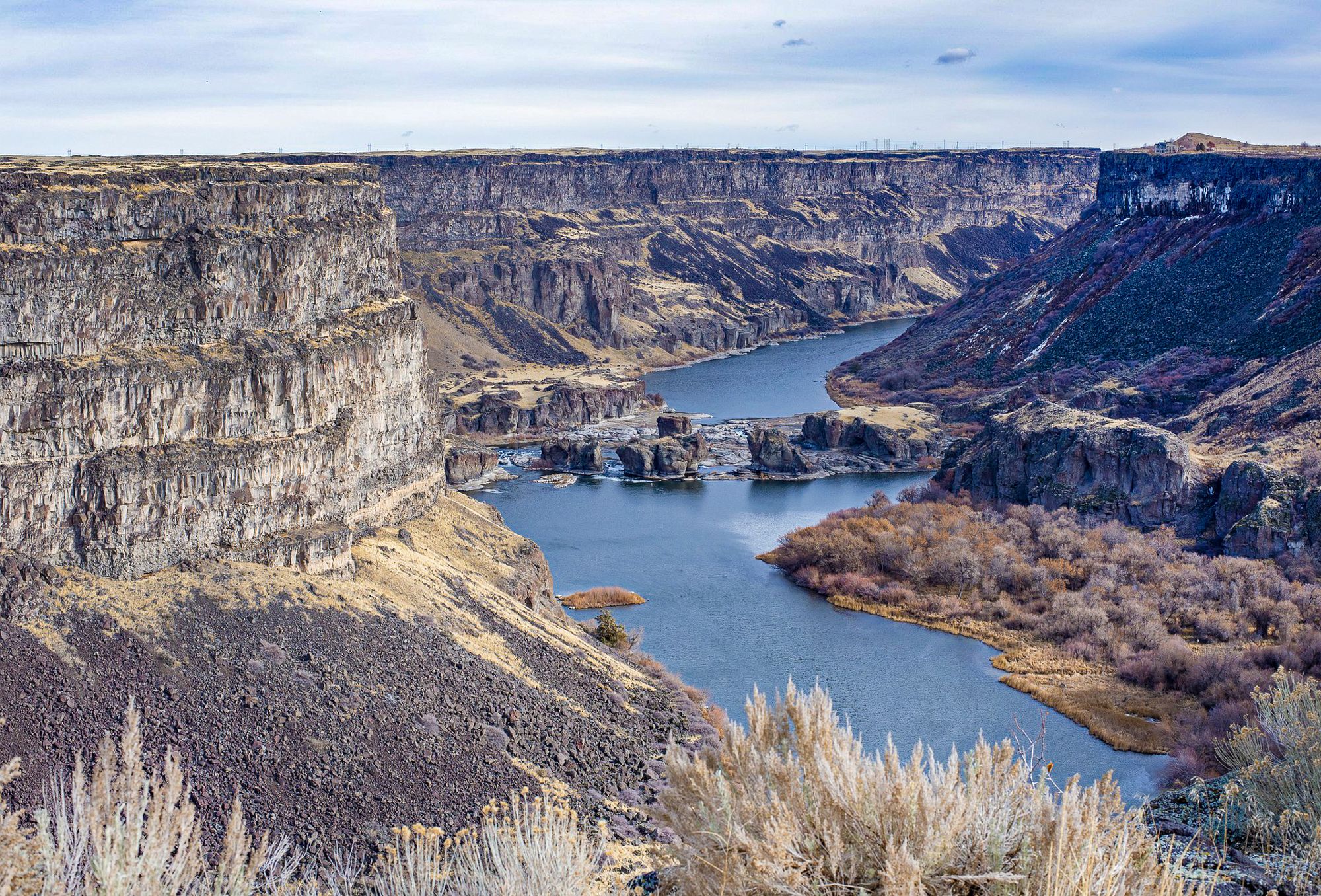
At some point, the rising lake waters lifted and weakened the ice lobe so that it broke and released the entire lake in an instant. These flood waters rushed across eastern Washington then funneled down the Columbia River along the Oregon-Washington border, carving dramatic and massive canyons, channels, and cliffs in the basalt.
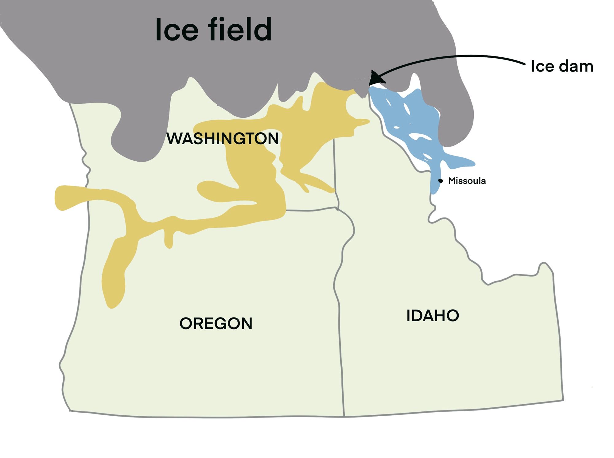
Each time the lake emptied, the ice lobe reformed, blocking the river again and making another lake. It is believed that this process repeated about 40 times, meaning that 40 massive floods (many of which were 400 times the volume of the Mississippi River!) repeatedly scoured and sculpted this landscape.
Every feature of these floods has been documented—from ripples and sand bars, to waterfalls and channels—and you can now drive this landscape with guidebooks that describe these features in fascinating detail, which makes for an absolutely incredible, must-see road trip for nature nerds like us!
Paid subscribers are the lifeblood of this newsletter so please consider upgrading from a free to a paid subscription to help support the effort it takes to research and create these newsletters. Thank you for your support!
Member discussion